
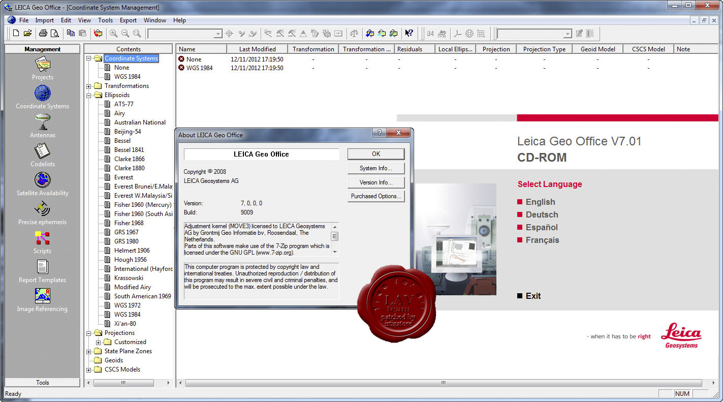
Description
Leica GEO Office the most powerful tools all in one common software to finalize their work were integrated quickly. Imported and integrated data from all your instruments to produce the final Ntyaj mix. Your data with Leica Geo Office to ensure you get the best results and incorporate management. This software is years of experience in the field of surveying and GNSS data processing in the most Qdtmnd processing options in the world. Leica Geo Office enables you to transfer data between different modules without the need to manage your projects in an integrated way to pay.
There is a feature Leica GEO Office:
- Support Tools for GNSS, TPS and levels
- GNSS data processing techniques using SmartCheck
- Processing TPS – from simple station updates to complex traverses
- Surface Processing
- Adjust the composition of the network
- Calculations COGO, transformation base and volume calculations
- SmartStation GNSS processing using the automatic update settings
- The combination of ground-based data and GNSS, with an integrated set against
- Benefit from instant volume calculations and update the coordinates
To view the complete Leica GEO Office in here , see.
required system
Operating System
Microsoft® Windows ™ 7, XP or Vista
RAM: 512 MB
Pictures


Reviews
There are no reviews yet.